Advent Day 5: Land Use / Land Cover
Dec 5, 2025
If hyperspectral imagery gives you the fine scale chemical and structural nuances of the world, land use / land cover (LULC) maps give you the big picture. They categorize the Earth’s surface into a systematic structure enabling for large-scale ecological analysis. LULC data are often dismissed as “just a classification,” but these maps are the backbone of countless ecological studies, conservation plans, and ecosystem models.
At their core, LULC products translate spectral information (often from multispectral data) into discrete classes through classification algorithms. What you get is a spatially explicit snapshot of how humans and ecosystems share space, and how LULC changes over time. Forests are logged, wetlands drained, agricultural areas intensify or are abandoned, and urban areas expand. Many LULC datasets are produced annually or even more frequently, which means ecologists can track change at temporal scales relevant to biodiversity, climate, and policy.
A huge part of why LULC mapping is even possible at global scales is Landsat. Landsat satellites have been collecting continuous, harmonized, publicly accessible record of the Earth’s surface since 1972. Landsat’s decades of consistent multispectral observations allow ecologists to examine not just LULC at a given place and time, but how it has changed across half a century of disturbance, recovery, and human activity.
Of course, LULC data come with caveats. Class boundaries can be fuzzy, spectral signatures overlap, and categories are only as good as the training data and definitions used. And because LULC maps involve classification, they necessarily compress continuous landscapes into discrete labels, which can oversimplify things that ecologists may be interested in.
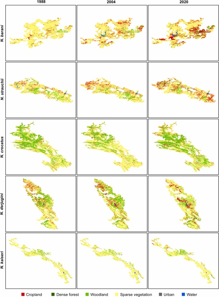
Still, when the goal is to understand how ecosystems are arranged, how they’re changing, and how these changes have impacted the myriad of species on our planet, like newts in this analysis by Niknaddaf et al 2023, LULC maps provide a valuable tool that can help ecologists connect local observations to landscape patterns and global trends.
References
Niknaddaf, Z., Hemami, M.-R., Pourmanafi, S., & Ahmadi, M. (2023). An integrative climate and land cover change detection unveils extensive range contraction in mountain newts. Global Ecology and Conservation., 48. https://doi.org/10.1016/j.gecco.2023.e02739