Advent Day 1: What can remote sensing do for ecologists?
Dec 1, 2025
Remote sensing can feel intimidating, but at its core, it’s simply a way of making consisten, spatially and temporally extensive measurements of the natural world without being physically present. In that way, remote sensing adds something ecologists already value. Instead of surveying 20 plots, you can observe entire landscapes. Instead of a single field season, you can track decades of change. Remote sensing gives you the ability to place your study area in a larger context, where it sits within larger patterns, whether local observations represent broader processes, or how ecosystems behave across gradients
The strength of remote sensing is not replacing ecological measurements, but scaling them up and connecting them to processes occurring across climate and elevation gradients, moisture regimes, disturbance histories,and more. Remote sensing expands the ecological questions you can ask, whether about structure, phenology, disturbance, stress, or long-term change.
This Advent series introduces 24 practical tools, each answering the same question: “What can remote sensing help me understand about ecological systems?”.
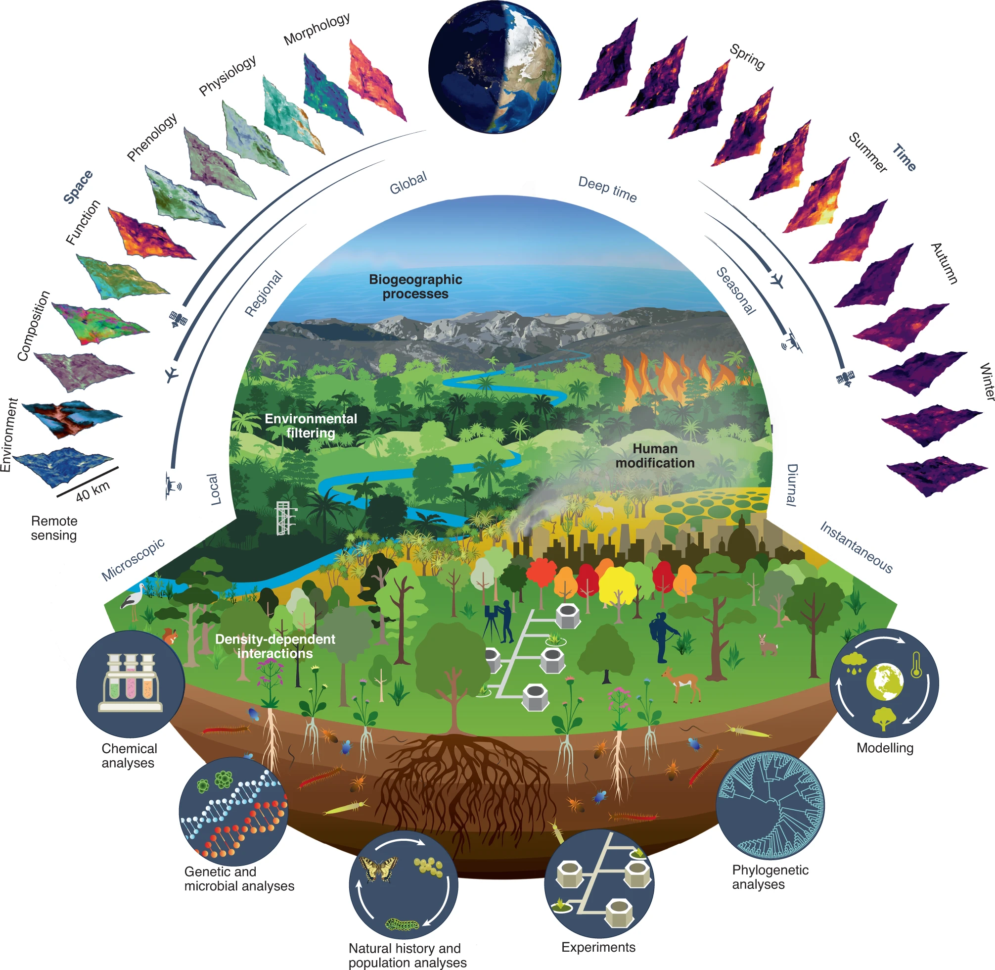
This figure from Cavender-Bares et al., 2022 captures how remote sensing complements ecological (and evolutionary) research by adding spatial and temporal context to the many tools already used. It highlights how remote sensing observations connect local biological processes with regional-to-global environmental patterns and processes.
References
Cavender-Bares, J., Schneider, F. D., Santos, M. J., Armstrong, A., Carnaval, A., Dahlin, K. M., Fatoyinbo, L., Hurtt, G. C., Schimel, D., Townsend, P. A., Ustin, S. L., Wang, Z., & Wilson, A. M. (2022). Integrating remote sensing with ecology and evolution to advance biodiversity conservation. Nature Ecology & Evolution, 6(5), 506–519. https://doi.org/10.1038/s41559-022-01702-5